
Cartes géographiques et atlas
- 16 Atlas
- 792 Cartes géographiques
- 112 Plans
Date de sortie
Disponibilité
Prix
- 74 inférieur à 5 €
- de 5 à 10 €
- 2593 de 10 à 20 €
- 2291 de 20 à 40 €
- 80 supérieur à 40 €
-

-

-

-

-

-

-
 Top 100, 170, Top100170 Montpellier / Nimes / Beziers 1/100.000XxxIGN – Institut Géographique National8,40
 -
 Top 100, 156, Top100156 Le-Puy-En-Velay / Privas / Mende 1/100.0XxxIGN – Institut Géographique National8,40
 -
 Top 100, 153, Top100153 Perigueux / Bergerac 1/100.000XxxIGN – Institut Géographique National8,40
 -
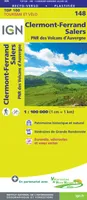 Top 100, 148, Top100148 Clermont-Ferrand / Salers 1/100.000XxxIGN – Institut Géographique National8,40
 -
![[France] départementale, routière et touristique, D23-87, D721317 Creuse.Haute-Vienne (23.87)](//cdn.leslibraires.fr/x55fiuOpi3fLTI_Lof1g34OBB8yaRsFYt_abHFUggkc/s:200:200/NTYzMjc0Nw.webp) [France] départementale, routière et touristique, D23-87, D721317 Creuse.Haute-Vienne (23.87)XxxIGN – Institut Géographique National5,90
[France] départementale, routière et touristique, D23-87, D721317 Creuse.Haute-Vienne (23.87)XxxIGN – Institut Géographique National5,90 -

-
![[France] départementale, routière et touristique, D15-19, D721312 Cantal.Correze](//cdn.leslibraires.fr/4uuAEU9K3DVduP78n2GnKGv_-5PstkSkK4TMRSllYhg/s:200:200/MTI5NTA4MzY.webp) [France] départementale, routière et touristique, D15-19, D721312 Cantal.CorrezeXxxIGN – Institut Géographique National5,90
[France] départementale, routière et touristique, D15-19, D721312 Cantal.CorrezeXxxIGN – Institut Géographique National5,90 -

-

-

-

-

-

-

-

-

-

-


![[France] départementale, routière et touristique, D23-87, D721317 Creuse.Haute-Vienne (23.87)](http://cdn.leslibraires.fr/x55fiuOpi3fLTI_Lof1g34OBB8yaRsFYt_abHFUggkc/s:200:200/NTYzMjc0Nw.webp)

![[France] départementale, routière et touristique, D15-19, D721312 Cantal.Correze](http://cdn.leslibraires.fr/4uuAEU9K3DVduP78n2GnKGv_-5PstkSkK4TMRSllYhg/s:200:200/MTI5NTA4MzY.webp)


